Our Project on the Topography of Jewish Life in Germany
Stumbling stone in remembrance of Editha Machol in Yorkstraße 88 in Berlin-Kreuzberg; Jewish Museum Berlin
“I was playing Hans-Jürgen for you again,” my father said gleefully when he called me over Whit Weekend. Hans-Jürgen is 68, a retired teacher, and interested in regional Jewish history. My father, however, is not a retired teacher and his name is actually Rudi, but he had displayed what one could call Hans-Jürgenesque behavior: he participated in a public tour of a Jewish cemetery in his hometown, recorded his impressions with a camera, and sent them to us in Berlin. For Hans-Jürgen doesn’t really exist: he’s just a fictitious person we used in order to develop a prototype – a kind of pre-testing version – for a cartographic app. This prototype is the foundation for the online portal, which we at the Jewish Museum Berlin want to complete construction on in the next two years. The goal is to gather – all in one place, for the first time – comprehensive geographical information on Jewish life in Germany and make it accessible online in an interactive map.
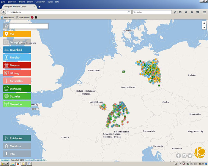
Prototype for “Topography of Jewish Life in Germany”
The prototype, which we’ve been able to create with support from the Rothschild Foundation (Hanadiv) Europe, serves to develop a concept for the design and information architecture of the prospective portal. Thus a map has been generated, within the borders of today’s Germany, showing synagogues, cemeteries, mikvehs (ritual baths), and schools as well as secular sites such as the location of music and athletic clubs, reading groups, and so on.
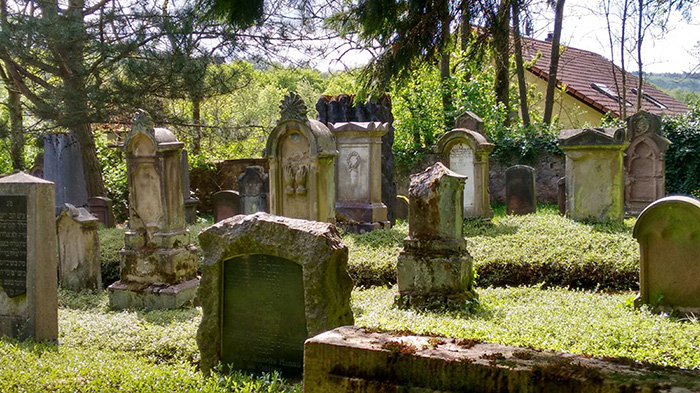
Jewish Cemetery Ottweiler, May 2016; photo: Rudi Müller
By taking pictures of the Jewish cemetery and sending them to us, my father was seizing on the idea of ‘collaborative mapping’, which has been central to the development of our map. The map, after all, should be able to be continually expanded upon, with visitors to the website helping to shape it. Users are invited to upload and share their own pictures, films, and texts together with geographic coordinates. After editorial verification the information will be published as ‘user generated content’.
The idea of collaborative mapping also means that we incorporated into our map the many websites on regional Jewish history generated in recent years, by public institutions but also by local initiatives and engaged private citizens. The sites, though already online, are mostly unconnected to each other and don’t all meet current technical standards. Thus the map should end up providing more visibility to these websites.
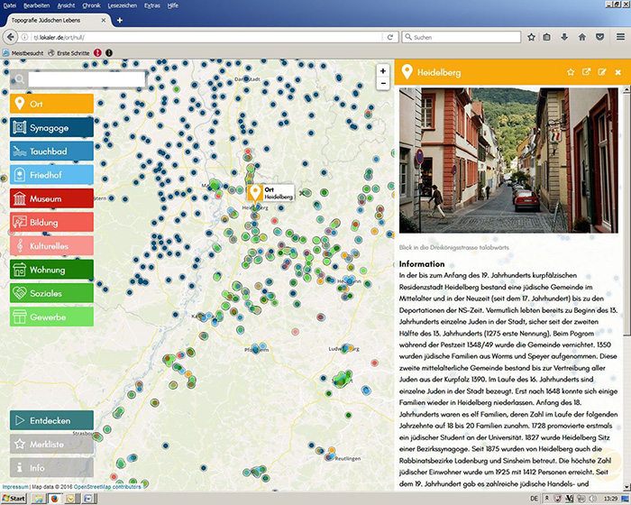
Prototype for “Topography of Jewish Life in Germany”; photo of Heidelberg: Joachim Hahn, 2004, text: Joachim Hahn, www.alemannia-judaica.de
To appeal not only to amateur historians like our imaginary Hans-Jürgen but also to younger audiences, the portal is being developed in close connection with “on.tour – The Jewish Museum Berlin Tours Schools” (further information on our website), which brings a mobile exhibition to schools across Germany. Through its workshops, on.tour offers schoolchildren a greater understanding of Jewish history in their regions. Our new map will be deployed in this context in the future as well.
I also discovered my inner Hans-Jürgen, jumping off my bike in Berlin to photograph a kosher supermarket or previously Jewish apartment building, and have become much more attentive while travelling through the city. We hope that our visitors will have a similar experience and that they will want to contribute to the map. The portal is scheduled to go online in the middle of 2018. Anyone who already wishes to share content before that date, however, should feel free to write to d.mueller@jmberlin.de.
Dana Müller accompanied the on.tour bus to the Rheinland-Palatinate region, discovering Jewish sites in Mainz.